From late 2024 to early 2025, numerous unidentified drones were reported over U.S. cities and military bases. While some of these “mystery craft” were later attributed to FAA-authorized research and other purposes, their presence highlighted the potential threat and vulnerability of defense and infrastructure facilities. Paul Lushenko, chief strategist for the U.S. military’s Joint Counter Small Unmanned Aircraft Systems Office (JCO), joined host Tom Spahr to discuss these concerns. Lushenko also underscored the ongoing efforts to refine doctrine, training, and policy to effectively address the evolving challenge posed by unmanned aircraft systems.
Here are the articles co-authored by Paul Lushenko mentioned in the show:
And so, really, what you want to do is try to synchronize your capability—lethal, non-lethal—across time and space to achieve as much standoff as possible before it comes very close.
Podcast: Download
Subscribe: Apple Podcasts | Spotify | Amazon Music | Android | Pandora | iHeartRadio | Blubrry | Podchaser | Podcast Index | TuneIn | Deezer | Youtube Music | RSS | Subscribe to A Better Peace: The War Room Podcast
Paul Lushenko is a U.S. Army lieutenant colonel and serves as the Chief Strategist and Director of Future Studies and Wargaming for the Joint Counter-Small Unmanned Aircraft Systems Office. He is an Adjunct Professor at the U.S. Army War College, a globally recognized expert on emerging technologies and war, and widely publishes on the intersection of emerging technologies, politics, and national security. Paul earned a Ph.D. from Cornell University, where he served as a U.S. Army General Andrew Jackson Goodpaster Scholar; holds numerous master’s degrees; and, has a B.S. from the U.S. Military Academy.
Thomas W. Spahr is the DeSerio Chair of Strategic and Theater Intelligence at the U.S. Army War College. He is a retired colonel in the U.S. Army and holds a Ph.D. in History from The Ohio State University. He teaches courses at the Army War College on Military Campaigning and Intelligence.
The views expressed in this presentation are those of the speakers and do not necessarily reflect those of the U.S. Army War College, U.S. Army, or Department of Defense.
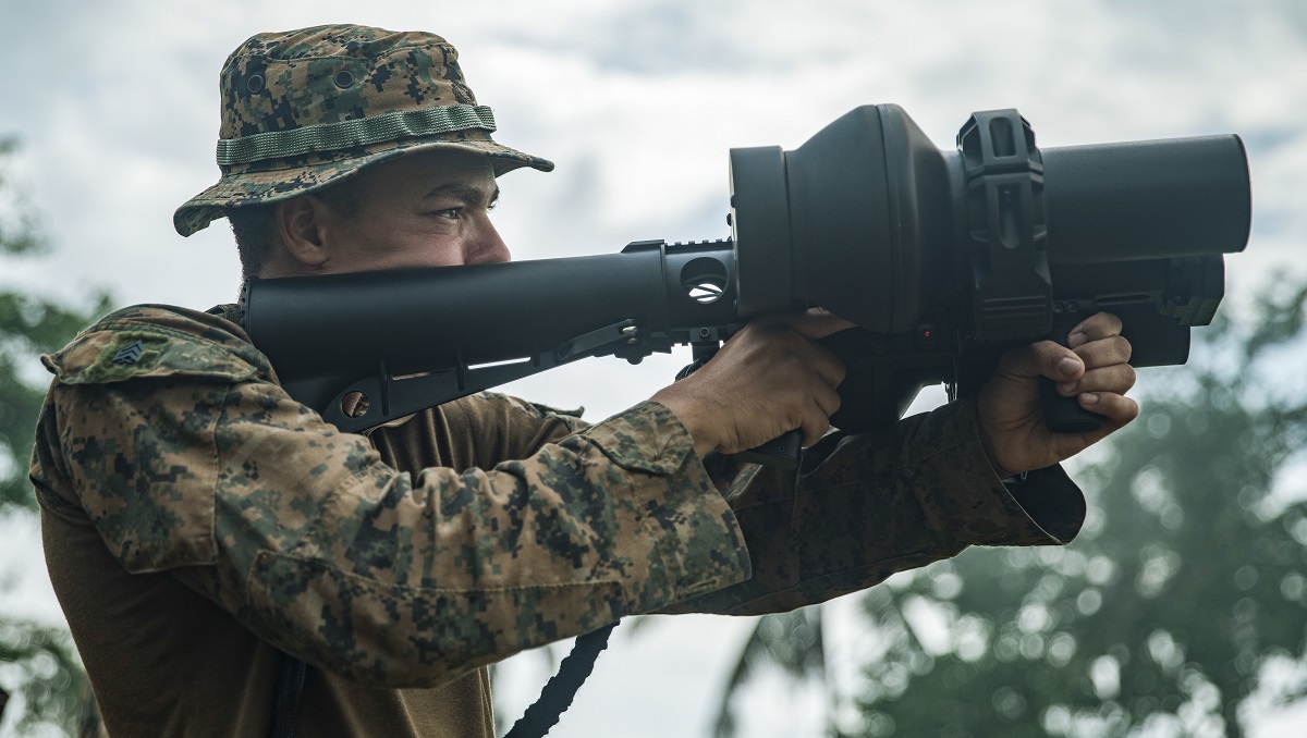
Photo Description: U.S. Marine Corps Sgt. Colin Clark, a mortarman assigned to Bravo Company, Battalion Landing Team 1/5, 15th Marine Expeditionary Unit, and a native of Texas, engages a target with a NightFighter S counter-unmanned aerial vehicle system during a demonstration for Philippine Marines assigned to Intelligence Company, 3rd Marine Brigade, as part of exercise KAMANDAG 8 at Tarumpitao Point, Palawan Province, Philippines, Oct. 17, 2024.
Photo Credit: U.S. Marine Corps photo by Sgt. Amelia Kang


An important discussion of a here-and-now, threat to particularly the US homeland.
IMHO for the homeland defense problem set, in addition to the POS registration requirement, there are two other necessary, but not solely sufficient, elements needed to help tackle domestic drone identification and collateral damage challenges of domestic CUSS.
1) We must add a cell phone app based flight plan filing system to feed identification data to the FAA, military or LE defenders.
Having a cell phone app is important to ensure a low bar of entry for drone operators to easily file their identification, location, lateral range of operation and intended altitude operating area.
2) We must also have a whole of government effort to develop/update national low altitude fly, approved fly, and no fly zones. This will require SLT and multiple Federal Agency inputs (I.e. DOD, DOE, FAA, FCC . . .).
Once established, this information (appropriately edited for security) would provide drone operators easily useable real-time data on where they can fly, need approval or cannot fly as well as an app based approval request method.
For example, flying over a corn field in the middle of Iowa would be labeled green, for no approval needed. Flying somewhat near an important infrastructure element would be labeled yellow for flight allowed with approval. Flight over or too close to an important infrastructure element would be labeled red for not allowed (drone destruction likely and legal consequences likely for the operator). Furthermore, high importance transient events (I.e. Super Bowl) could be rapidly updated to show the expansion of surrounding yellow and red zones.
The availability of this data would aid defenders in identification and weapons engagement decisions. Furthermore, its absence would be a valuable indicator of hostile intent.
My nickel on the grass.